

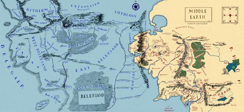
Ive been racking my brain as to the locations of Belegost and Nogrod during the 3rd age for some time, whether they were sunk in the gulf of Lhun or not. this map atleast confirms they both should exist in some state during the 3rd age.

title available
Posted 27 November 2012 - 12:08 AM
Student of Homer.

Posted 27 November 2012 - 12:55 AM
LEGO Knight of Minas Ithil

Posted 27 November 2012 - 01:06 AM
Remember that all worlds draw to an end and that noble death is a treasure which no one is too poor to buy. - C.S. Lewis
There will come a time when you believe everything is finished. That will be the beginning. - Louis L'Amour
What will matter then will be people. If relationships will matter most then, shouldn't they matter most now? - Max Lucado

Posted 27 November 2012 - 02:34 AM
Mapper

Posted 27 November 2012 - 11:07 AM


title available
Posted 27 November 2012 - 03:35 PM
***

Posted 28 December 2012 - 07:36 PM
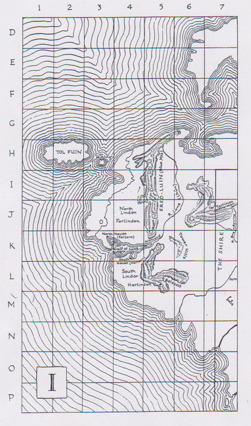
I wanted to ask if it is accurate?
Ive been racking my brain as to the locations of Belegost and Nogrod during the 3rd age for some time, whether they were sunk in the gulf of Lhun or not.

Edited by Námo, 28 December 2012 - 08:05 PM.


0 members, 0 guests, 0 anonymous users


